Add your own picture and explain the route, parking, gates, paths or landmarks that help people find it.
Earn 5 points after the picture is checked and accepted.
Add your photo and local directionsShare what you foundWhat is recorded here
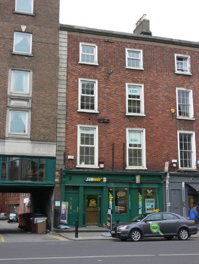
Terraced two-bay four-storey over basement former house, built c.1850, having shopfront to front (east) elevation and single-storey and two-storey extensions to rear (west) elevation, corrugated-iron to first floor of latter. Now in use as restaurant, with language school to upper floors. Flat roof concealed behind cut granite parapet, flat felt roof to extensions, rendered chimneystacks with clay pots. Carved granite cornice and render eaves course over red brick, laid in Flemish bond, to wall to front, having rusticated granite quoins. Yellow brick, laid in Flemish bond, to rear (west) elevation. Square-headed window openings with moulded masonry architraves, masonry sills, round-headed window opening to rear, having steel bars, replacement uPVC windows throughout. One timber framed casement window to rear extension. Shopfront comprising timber panelled pilasters, acanthus leaf moulding to scrolled console brackets, carved cornice over nameplate with recent lettering. Square-headed door and window openings having recent fittings. Square-headed door opening with timber awning windows to overlight, timber panelled door having brass fittings and nosed granite step with some cast-iron railings. Square-headed carriage arch opening to south. Replacement basement lights. Street fronted on Lincoln Place facing north-east to junction with Westland Row.
This official record and map point do not grant access. Most recorded buildings are privately owned; view them only from public ground unless the owner allows entry.