Add your own picture and explain the route, parking, gates, paths or landmarks that help people find it.
Earn 5 points after the picture is checked and accepted.
Add your photo and local directionsShare what you foundWhat is recorded here
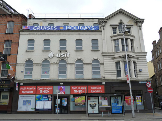
Corner-sited attached gable-fronted single-bay four-storey commercial building, built 1911, with five-bay block attached to east, now in use as offices. Pitched slate roof, having dormers to west, with red brick chimneystacks. Parapet with moulded eaves course and brackets, set on capitals having cartouches over foliate detailing. Moulded eaves course to west elevation. Painted brick, flanked by panelled rendered pilasters, over moulded masonry cornice and channelled rendered walls to first floor. Brown brick walls laid in English garden wall bond over lined-and-ruled rendered and smooth rendered walls with recessed square-headed panels to west elevation. Double-height canted bay oriel window with timber sliding sash windows to first and second floors having carved masonry cornices, broken-bed pediment to first floor, channelled render apron, moulded masonry architrave and scrolled console to centre window to first floor. Venetian window over, having Ionic pilaster supporting pulvinated frieze and dentillated cornice, scrolled console and wreath to keystone. Square-headed window openings with continuous moulded masonry sill courses, render keystone details, having raised rendered surrounds to second floor. Six-over-two pane, six-over-one pane and four-over-one pane timber sliding sash windows. Recent openings and fittings to shopfront to ground floor. Located on south side of Aston Quay to west of O’Connell Bridge.
This official record and map point do not grant access. Most recorded buildings are privately owned; view them only from public ground unless the owner allows entry.