Add your own picture and explain the route, parking, gates, paths or landmarks that help people find it.
Earn 5 points after the picture is checked and accepted.
Add your photo and local directionsShare what you foundWhat is recorded here
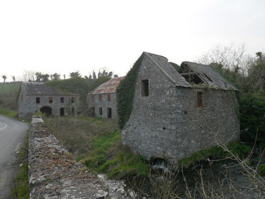
Corn mill complex consisting of three detached two-storey buildings forming three sides of courtyard, built c.1800, refurbished and converted to flax mill c.1880, on north bank of River Fane. Four-bay two-storey mill-related building to west of central yard having pitched corrugated-iron roof, snecked dressed stone walls with square-headed window openings and door opening and segmental carriage arch, all having red brick surrounds. Six-bay two-storey mill building forming north edge of central yard having corrugated-iron roof, roughly dressed stone walls, square-headed openings having red brick surrounds and some timber battened shutters. Adjoined to west building by round arch of stone and brick at eaves level. Round-arch opening to front and rear elevations to wheel-pit to east end. Some machinery remaining internally. Multiple-bay two-storey mill-related building to east range having remains of pitched slate roof, rubble stone walls and square-headed openings with red brick surrounds. Red brick segmental arch at river level to north and south gables, allowing river flow through east side of building. No evidence of machinery. Detached single-storey three-bay miller's house to north of complex, now ruinous. Steep increase in ground level to immediate rear (north) of complex. Situated on roadside adjacent to road bridge over River Fane forming boundary between Counties Monaghan and Armagh.
This official record and map point do not grant access. Most recorded buildings are privately owned; view them only from public ground unless the owner allows entry.