Add your own picture and explain the route, parking, gates, paths or landmarks that help people find it.
Earn 5 points after the picture is checked and accepted.
Add your photo and local directionsShare what you foundWhat is recorded here
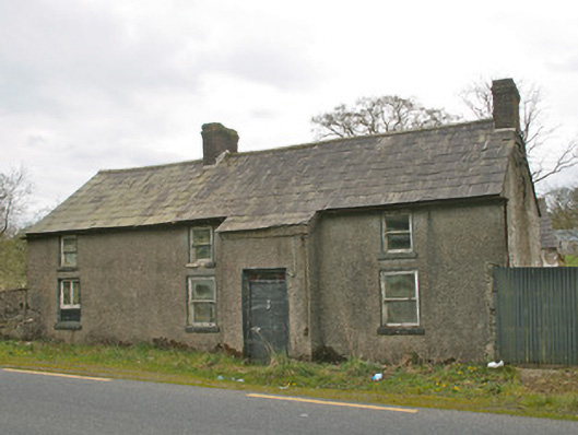
Detached four-bay two-storey vernacular house, built c.1850, now vacant, with farm buildings to west. Originally comprised of three-bay house, extended by one bay to south. Pitched natural slate roof, gabled to north and south, with clay ridge tiles, and cast-iron rainwater goods. Two red brick chimneystacks, on north gable end and at junction with extension to south. Roughcast rendered walls. Square-headed window openings, having one-over-one pane timber sliding sash windows, diminishing to first floor, with rendered reveals and painted stone sills. Breakfront to front elevation, rising to meet slope of roof as catslide. Square-headed door opening with replacement metal door, having rectangular paned coloured glass over-light. Two-storey farm buildings to west, having pitched slate roofs and exposed rubble and limewashed stone walls, square-headed openings and external steps to loft to north elevation of outbuilding. Wrought-iron traffic gate to south, hanging on one roughcast rendered round-plan gate pier with render conical cap. Located to west of Castleblayney to Keady road, south of Creaghanroe crossroads.
This official record and map point do not grant access. Most recorded buildings are privately owned; view them only from public ground unless the owner allows entry.