Add your own picture and explain the route, parking, gates, paths or landmarks that help people find it.
Earn 5 points after the picture is checked and accepted.
Add your photo and local directionsShare what you foundWhat is recorded here
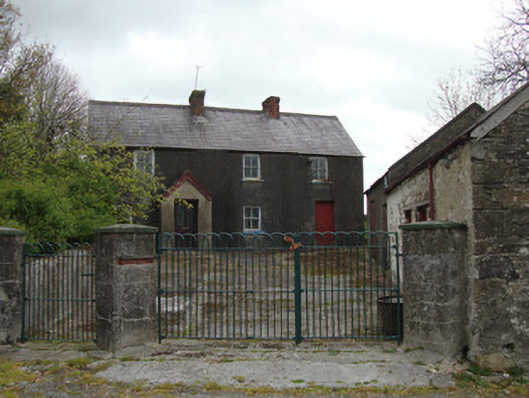
Detached four-bay two-storey vernacular house, built c.1800, with gabled windbreak to front elevation, single-bay single-storey lean-to extension to west end, and incorporating outbuilding to ground floor of east end. Now vacant. Pitched natural slate roof with terracotta ridge tiles, cast-iron rainwater goods, and two red brick chimneystacks. Roughcast rendered walls to south, east and west elevations, exposed coursed rubble limestone walls to north elevation. Square-headed window openings with red brick block-and-start window surrounds, two-over-two pane timber sliding sash windows with rendered reveals and painted stone sills, one one-over-one pane sash window to ground floor of south elevation. Porch has pitched slate roof and square-headed replacement timber door. Square-headed timber battened door to easternmost bay of front elevation. Lean-to has corrugated-iron roof and square-headed two-over-two pane timber sliding sash windows. Outbuildings to front at right angle, one with pitched corrugated-iron roof and roughcast rendered walls, other with pitched slate roof and limewashed rubble and brick walls. Square-headed openings with timber battened doors to both outbuildings. Enclosed yard bounded by outbuildings to east, with coursed rubble and roughcast rendered boundary wall to west, and house to north. Pedestrian gates to east and west of house. Wrought-iron pedestrian and vehicular gates to south with rendered red brick square-plan gate piers. Located on rural country road, post box c.1905 directly opposite house in square-plan brick pier, likely to have been farming entrance with ruin of single-storey farm building in field opposite.
This official record and map point do not grant access. Most recorded buildings are privately owned; view them only from public ground unless the owner allows entry.