Add your own picture and explain the route, parking, gates, paths or landmarks that help people find it.
Earn 5 points after the picture is checked and accepted.
Add your photo and local directionsShare what you foundWhat is recorded here
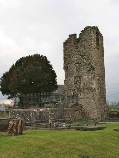
Freestanding square-plan mausoleum with crypt beneath, built c.1840. Smooth rendered coursed rubble limestone plinth walls to north, south and west elevations having moulded limestone coping and cast-iron railings, ashlar limestone wall to basement to east elevation. Two table-tombs to flat roof of mausoleum, having limestone caps over three limestone block supports. Entrance to crypt from east, with square-headed door opening having replacement metal door, under voussoirs of segmental-headed relieving arch. Entrance shared with mausoleum to east, divided by party wall, now covered over by late twentieth-century mesh guard. Single-bay three-storey ruined square-plan tower of ancient church to west, having rubble limestone walls with some sand lime render, evidence of pitched roof to east face, square and segmental-headed window openings filled with limestone rubble and red brick. Located in graveyard to south of Saint Coleman’s Church.
This official record and map point do not grant access. Most recorded buildings are privately owned; view them only from public ground unless the owner allows entry.