Add your own picture and explain the route, parking, gates, paths or landmarks that help people find it.
Earn 5 points after the picture is checked and accepted.
Add your photo and local directionsShare what you foundWhat is recorded here
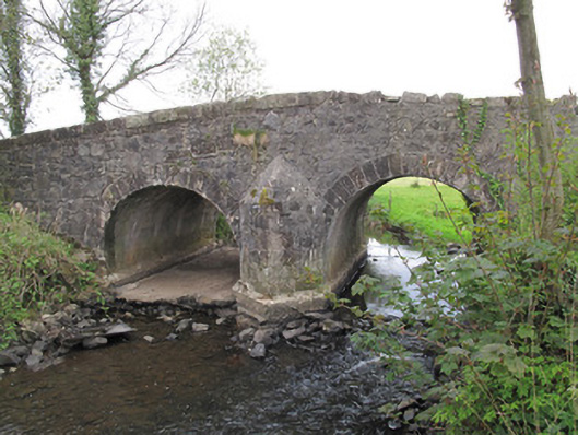
Double-arch humpback limestone bridge, built c.1800, carrying road over stream. Round arches, having dressed stone voussoirs and gunnelled soffits. Arch to west now dry and having cement to river bed. Arches and central pier reinforced with concrete. V-shaped cutwaters of squared stone with conical caps to each elevation. Random rubble stone to spandrels and parapets, portions of dressed stone copings to parapets.
This official record and map point do not grant access. Most recorded buildings are privately owned; view them only from public ground unless the owner allows entry.