Add your own picture and explain the route, parking, gates, paths or landmarks that help people find it.
Earn 5 points after the picture is checked and accepted.
Add your photo and local directionsShare what you foundWhat is recorded here
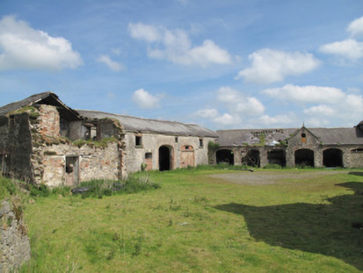
Range of outbuildings, built c.1845, to rear (north-west) of Drumreaske House. L-plan two-storey multiple-bay block to west, south wing partly demolished. Seven-bay single-storey arcaded block to east, terminating in two-storey square-plan tower to south. Pitched slate roofs, with terracotta ridge tiles, and dressed stone eaves course. Lean-to roof to single-storey block, rear forming part of south-west elevation of walled garden. Central gable-fronted bay to front (south-west) elevation, with tooled stone coping and finial. Roughly coursed squared rubble stone walls, with red brick infill to some areas. Decorative tiled panel to central bay to south-west elevation, with date of 184-. Square-headed window openings having dressed stone sills and timber fittings. Three-centred arch opening to south-east elevation with dressed gauged stone voussoirs. Gauged-brick three-centred arches to south-east elevation having red brick surrounds, one blocked. Arcade of gauged-brick three-centred arches to south-west elevation. Gauged-brick oculus to central pedimented bay. Square-headed openings to tower to south, some blocked, some with red brick surrounds. Square-headed door openings to north-east elevation of tower, with timber fittings, overhanging eaves supported on timber columns to north-east elevation, and timber balcony to first floor.
This official record and map point do not grant access. Most recorded buildings are privately owned; view them only from public ground unless the owner allows entry.