Add your own picture and explain the route, parking, gates, paths or landmarks that help people find it.
Earn 5 points after the picture is checked and accepted.
Add your photo and local directionsShare what you foundWhat is recorded here
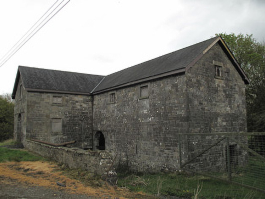
Detached L-plan split-level former corn mill, built c.1850, two-storey to front (west) elevation and three storey to rear (east) elevation, with attic storey. Pitched replacement slate roof with timber bargeboards and cast-iron rainwater goods. Snecked squared sandstone walls, with dressed block-and-start quoins. Square-headed window openings having tooled sandstone sills and lintels and gauged-brick square-headed window openings with red brick surrounds. Window openings boarded up or having timber fittings. Opening to south elevation having leaded window panes. Square-headed door opening to south elevation, with tooled sandstone surround. Gauged masonry round-headed door openings at basement level and ground floor level to east elevation, with tooled stone voussoirs. Positioning of floors to interior visible by spaces to wall. Wheel-pit and machinery visible to west elevation, mill race also visible to west.
This official record and map point do not grant access. Most recorded buildings are privately owned; view them only from public ground unless the owner allows entry.