Add your own picture and explain the route, parking, gates, paths or landmarks that help people find it.
Earn 5 points after the picture is checked and accepted.
Add your photo and local directionsShare what you foundWhat is recorded here
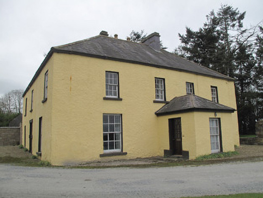
Detached four-bay two-storey house L-plan, built c.1720, later enlarged and later again reduced in size c.1800, having three-bay east side elevation (original front elevation), with lean-to roofed extension to re-entrant corner, and porch to front (east) elevation. Hipped slate roof with rendered red brick chimneystacks and clay chimneypots, pitched roof to return, terracotta ridge tiles, render eaves course and mixed cast-iron and replacement rainwater goods. Hipped slate roof to porch. Roughcast rendered walls. Square-headed openings throughout having painted tooled stone sills, rendered reveals and six-over-six pane timber sliding sash windows, smaller to first floor, and having one six-over-nine-pane window to rear. Painted tooled stone Gibbsian surround to original doorway, now window, in south elevation. Square-headed door opening to south elevation of porch with half-glazed timber panelled door, opening onto painted stone step flanked by blocks inset in wall, and having slate platform to front. Square-headed door opening to rear having chamfered render surround and replaced glazed timber door. Whitewashed coursed rubble stone outbuildings to rear of house with pitched corrugated-iron roofs, square and segmental-headed openings having corrugated iron doors. Pair of round-plan rubble stone piers with render capping and coursed rubble limestone walls to north-east of house.
This official record and map point do not grant access. Most recorded buildings are privately owned; view them only from public ground unless the owner allows entry.