Add your own picture and explain the route, parking, gates, paths or landmarks that help people find it.
Earn 5 points after the picture is checked and accepted.
Add your photo and local directionsShare what you foundWhat is recorded here
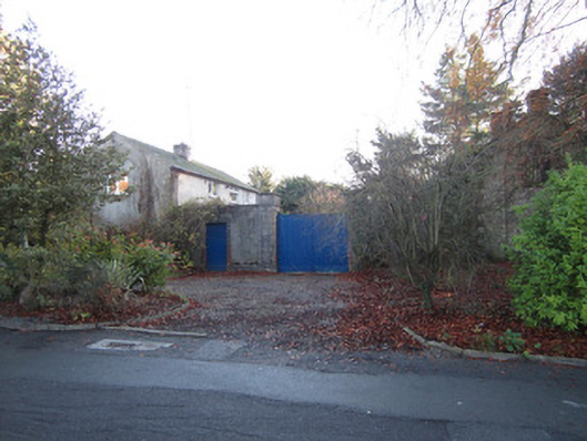
Detached stable yard, built c.1785, associated with now demolished Shirley House, comprising two multiple-bay two-storey blocks presenting slight round-headed recesses. North-east block now in use as dwelling. South-western block in use as outbuilding and has full-length part-stone and part-brick lean-to block to front. Pitched slate roofs with dressed limestone chimneystacks, one partly brick. Rendered walls with chanelled limestone quoins. Square-headed replacement uPVC windows to dwelling. Barred timber sliding sash window visible to road gable of second block. Yard has roughcast rendered walls with limestone plinths and copings, and square-plan ashlar piers with plinths and caps and supporting double-leaf timber battened vehicular gate. Square-headed pedestrian entrance to north-east of vehicular entrance having chamfered dressed limestone surround with replacement timber battened door. Elliptical-headed archway to south-east side of yard set in rendered wall.
This official record and map point do not grant access. Most recorded buildings are privately owned; view them only from public ground unless the owner allows entry.