Add your own picture and explain the route, parking, gates, paths or landmarks that help people find it.
Earn 5 points after the picture is checked and accepted.
Add your photo and local directionsShare what you foundWhat is recorded here
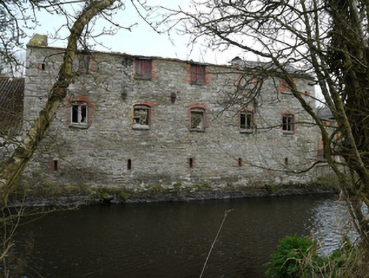
Attached five-bay three-storey watermill, built c.1860, as part of Inishkeen corn and flax mill complex, now derelict. Standing on north bank of River Fane and adjoined on west side by twentieth-century store. Short section of pitched slate roof remaining on east side, having two circular vents to ridge. Rubble stone walls with oval cast-iron tie-plates at second floor level. Red brick surrounds to openings and eaves course of red brick in header bond to long elevations. Two segmental-arch door openings at ground floor level. Square-headed door opening at first floor level served by concrete-framed platform having metal ladder. Square-headed window openings to first and second floor, with recessed red brick surround within brick segmental arch. Stone sills throughout. First floor window openings having timber fittings, vertical timber board shutters to second floor window openings. First and second floor window openings to east gable infilled with masonry. Ventilation gaps six bricks high to ground floor south elevation. Exposed timber beams to ground floor ceiling to interior, with single cross span metal beam beneath. Probable earlier single-storey lean-to structure indicated by traces on the west gable, and to east end of north elevation. Mill complex located east of Inishkeen village, associated buildings, including miller’s house, second mill and stores, forming courtyard between River Fane to south and millrace to north. Mill is located at end of short road off main road and accessed via two small bridges.
This official record and map point do not grant access. Most recorded buildings are privately owned; view them only from public ground unless the owner allows entry.