Add your own picture and explain the route, parking, gates, paths or landmarks that help people find it.
Earn 5 points after the picture is checked and accepted.
Add your photo and local directionsShare what you foundWhat is recorded here
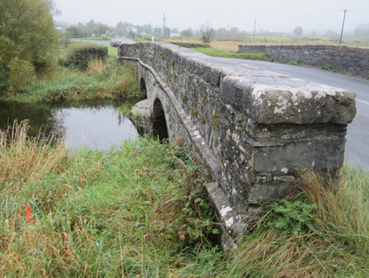
Two-arch slightly humpbacked stone bridge, built c.1760, carrying Castleblayney to Newtownhamilton road over stream linking Drumillard and Muckno Loughs. Walls of uncoursed rubble sandstone with segmental arches having heavy, punch-finished ashlar voussoirs and punched chamfered string course narrowing wing walls and spandrels to parapet wall with heavy, punched flat coping stones. Parapets are terminated on both sides by square piers and are splayed slightly outward on each side of road crossing with some recent repairs with guillotined stone to south-east parapet. South-east parapet abuts low rubble stone field wall continuing on both sides of bridge. Bridge surface has soft grass margin to each side and no positive drainage. Upstream and downstream sides both have curved, pointed cutwaters.
This official record and map point do not grant access. Most recorded buildings are privately owned; view them only from public ground unless the owner allows entry.