Add your own picture and explain the route, parking, gates, paths or landmarks that help people find it.
Earn 5 points after the picture is checked and accepted.
Add your photo and local directionsShare what you foundWhat is recorded here
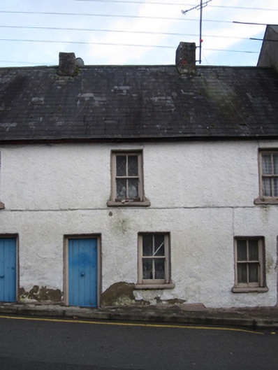
Mid-terraced single-bay two-storey vernacular house, built c.1820, having single-storey flat-roofed extension continuing across part of rear (east) elevation from adjacent house to south. Disused brick-built lean-to roofless privy on rear elevation to front of party wall and presumably shared between this and neighbouring house to north. Pitched slate roof to house with black clay ridge tiles, partially roughcast rendered chimneystacks to both party walls and half-round cast-iron rainwater goods. Limewashed roughcast rendered walls with smooth rendered projecting base and walls to rear extension composed of assorted sheets of plywood and board. Square-headed window openings throughout, with painted stone sills and two-over-two pane timber sliding sash frames. Square-headed battened timber front door, and replacement timber sheeted door with glazed panel and square overlight to rear elevation. Lower walls of demolished stone outbuilding to rear aligned parallel to terrace of houses.
This official record and map point do not grant access. Most recorded buildings are privately owned; view them only from public ground unless the owner allows entry.