Add your own picture and explain the route, parking, gates, paths or landmarks that help people find it.
Earn 5 points after the picture is checked and accepted.
Add your photo and local directionsShare what you foundWhat is recorded here
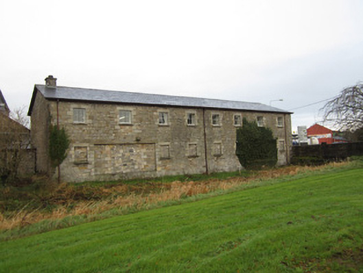
Detached eight-bay two-storey limestone-built former canal store, built c.1838. Now in use as school sports hall (McCarthy Hall), with gable-fronted entrance porch to middle of north elevation. Single-storey lean-to addition of c.1990 to same elevation. Pitched slate roof, with stone chimneystack, and cast-iron and some replacement aluminium rainwater goods. Squared rubble masonry walls with sandstone ashlar quoins and window surrounds. Square-headed window openings with block-and-start ashlar surrounds, stone sills and fixed six-pane metal-framed windows. Wider segmental-headed window opening to upper part of east gable. Square-headed door openings with block-and-start ashlar surrounds and tongue-and-groove timber battened doors. Blocked segmental-arch former vehicular openings to both long walls set into square-headed recesses and flanked by pedestrian doorways, one blocked. Building attached, via recent link, to three-bay two-storey ancillary building to north-west that appears to be former dwelling house of nineteenth-century date, having catslide porch to north-west end of front, pitched slate roof, rubble walls, and square-headed openings, ground floor windows now blocked up. South elevation of former canal store fronts onto disused Ulster Canal, adjacent to road/canal bridge at Dawson Street. Buildings are part of Saint Louis Convent complex.
This official record and map point do not grant access. Most recorded buildings are privately owned; view them only from public ground unless the owner allows entry.