Add your own picture and explain the route, parking, gates, paths or landmarks that help people find it.
Earn 5 points after the picture is checked and accepted.
Add your photo and local directionsShare what you foundWhat is recorded here
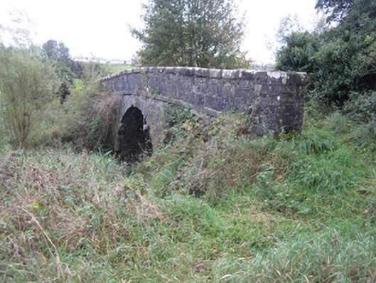
Single-arch limestone canal bridge and adjacent stone culvert, built c.1840, carrying access lane from Asylum Farm over Ulster Canal and towpath and sluiceway short distance south of seventeenth lock to small roadway and associated farmland to south-east. Parapet walls of roughly squared rubble with heavy, flat capping stones having rounded arrises and punch-finished surface. Square piers having heavy flat stone caps terminate each corner of parapets. Projecting square string course separates parapet from spandrels which have same construction as parapet walls. Segmental arch has punch-finished ashlar voussoirs and stone arch soffit over canal and towpath which is on ashlar sandstone raised eastern bank of canal. Both elevations obscured by ivy and trees growing on embankments either side of disused canal. Tree growth and ivy restricts views of some parts of bridge and top surface overgrown with grass with no evidence of hard surfacing or drainage. Barrel-vaulted ashlar stone culvert over sluiceway just east of canal bridge. Abutment walls are reinforced with concrete and culvert provides channel under earthen bank.
This official record and map point do not grant access. Most recorded buildings are privately owned; view them only from public ground unless the owner allows entry.