Add your own picture and explain the route, parking, gates, paths or landmarks that help people find it.
Earn 5 points after the picture is checked and accepted.
Add your photo and local directionsShare what you foundWhat is recorded here
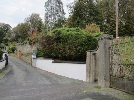
Boundary walls of St Davnet's Hospital complex, built c.1867 onwards. Various sections of rubble stone. Dry rubble stone retaining wall, approximately 1.5m high, to south-west embankment of former Roosky Lane (only element of site to predate development of existing hospital) on south-west of historic hospital site with short roughcast rendered section leading to gateway with square smooth-rendered piers having moulded caps and projecting bases. These hold decorative wrought-iron gates to vehicular access, flanked by square-headed pedestrian doorways in stub walls on each side terminating with lower square smooth rendered piers. Continuing northward from gateway, stepped, mortared coursed rubble stone wall with over-sailing rubble stone cap rises over steep incline and forms west boundary to hospital site continuing through thick overgrowth towards former railway line which forms north-west boundary of site. Present grounds incorporates part of back-filled former Great Northern Railway Line (completed to Monaghan in 1858) with south elevation of Asylum railway bridge (also back-filled) forming part of northern boundary to site. Next accessible section of hospital boundary wall is to north-east limit of site where section of mortared rubble stone wall with rubble stone coping, approximately 2 metres in total height exists, including remains of circular gate pier at access from original asylum farm to original sewage tanks. This section of wall extends south-eastwards to tow path of Ulster Canal which is just outside east boundary of site. Steel-sheeted gateway near most south-easterly corner of this wall is held on square ashlar piers rebated to only allow gates to open towards farmyard and away from canal. Ashlar gateway and adjoining wall most likely date to c.1867 when Asylum Farm was constructed despite association with earlier Canal which dates from c.1839. Final surviving visible historic element of hospital boundary wall is single defunct brick gate pier south of main former asylum building and east of entrance to derelict swimming pool previously serving access way to original hospital sewage tank located where present playing fields exist. Other sections of boundary to present hospital site are either inaccessible due to dense overgrowth or have been removed or replaced with modern boundary walls or fences.
This official record and map point do not grant access. Most recorded buildings are privately owned; view them only from public ground unless the owner allows entry.