Add your own picture and explain the route, parking, gates, paths or landmarks that help people find it.
Earn 5 points after the picture is checked and accepted.
Add your photo and local directionsShare what you foundWhat is recorded here
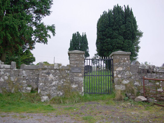
Graveyard on irregular-plan, laid out c. 1600. Now out of use. Contains a collection of multidenominational cut stone gravemarkers (upstanding, recumbent, and table-type memorials) mainly dating from c. 1750 to c. 1900. Two ashlar limestone mausoleums (on square-plan) to the north of site, dated 1835 and 1898, containing the remains of the Barton family. Rubble stone scalan (covered altar) to the north-west corner of enclosure, built c. 1800, having segmental-headed arch over with roughly dressed voussoirs to arch and with cut stone altar/seat to interior. Site surrounded by rubble stone boundary wall having castellated/Scotch coping over. Gateway to the east comprising a pair of rubble stone gate piers (on square-plan) having pyramidal coping over and with wrought-iron flat-bar gate. Stile located to the east side of gate. Site of earlier church to centre (RMP DG105-003001-) to centre, and remains of ringed cross (RMP DG105-003002-) to site. Located in an elevated site in the rural countryside to the north of Pettigoe.
This official record and map point do not grant access. Most recorded buildings are privately owned; view them only from public ground unless the owner allows entry.