Add your own picture and explain the route, parking, gates, paths or landmarks that help people find it.
Earn 5 points after the picture is checked and accepted.
Add your photo and local directionsShare what you foundWhat is recorded here
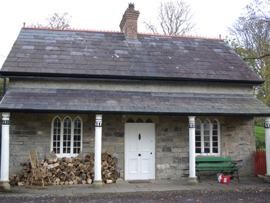
Detached three-bay single-storey with attic level gate lodge and former schoolhouse associated with Murvagh House (see 40909921), built c. 1820 and altered c. 1870, having continuous open veranda to the main elevation (west) supported on four decorative timber columns set on moulded stone pedestals. Now in use as a private house with modern single-storey extension to the rear (east). Pitched natural slate roof having terracotta ridge cresting, and with central red brick chimneystack with stepped coping and crowned terracotta chimneypots over. Some surviving cast-iron rainwater goods including decorative cast-iron hopper to the north gable. Mono-pitched natural slate roof over veranda; flagstones to veranda area. Squared and randomly coursed sandstone rubble walls, formerly roughcast rendered. Two tripartite/triple pointed-arch window openings to front elevation (west), one to either side of central doorway, each having continuous ashlar sandstone lintels, cut stone sills, and timber casement windows with intersecting tracery to heads. Central tripartite/triple pointed-arch doorway to the main elevation having continuous ashlar sandstone lintel over with pointed-arch overlights, and with timber panelled door. Set back from road adjacent to the north-east of the main entrance to Murvagh House comprising a pair of squared rubble stone gate piers with capstones over, and flanked to either side by sections of rubble stone walling. Located in mature landscaped and wooded grounds to the south-east of main building at start of long approach avenue to house. Sited adjacent to east of the Ballintra River and to the south of Donegal Town. Shores of Donegal Bay a short distance to the north.
This official record and map point do not grant access. Most recorded buildings are privately owned; view them only from public ground unless the owner allows entry.