Add your own picture and explain the route, parking, gates, paths or landmarks that help people find it.
Earn 5 points after the picture is checked and accepted.
Add your photo and local directionsShare what you foundWhat is recorded here
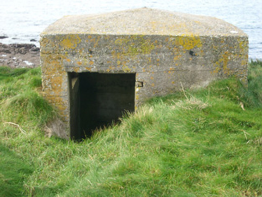
Remains of detached single-bay single-storey World War Two-era pillbox or observation post on triangular-plan, built c. 1940, now disused. Slightly domed mass-concrete roof and mass concrete walls. Long splayed horizontal openings to north-west and south-west faces; no fittings remain. Square-headed doorway to the east; fittings now gone. Located on a rocky outcrop on Castle Point, overlooking McSwyne’s Bay, and set within the fragmentary remains of McSywne’s Castle (RMP DG098-019001-). Site protected by cliff faces on the north, south and west sides. Located to the south-west of Dunkineely and to the north end of St. John’s Point.
This official record and map point do not grant access. Most recorded buildings are privately owned; view them only from public ground unless the owner allows entry.