Add your own picture and explain the route, parking, gates, paths or landmarks that help people find it.
Earn 5 points after the picture is checked and accepted.
Add your photo and local directionsShare what you foundWhat is recorded here
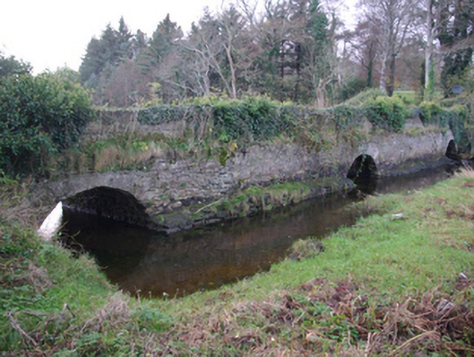
Triple-arched bridge/causeway formerly carrying road over mouth of small unnamed stream/tidal estuary, built c. 1775. Now in use as a garden feature associated with Bruckless House (see 40909802) with lawn to former road deck. Round-headed arches having roughly squared voussoirs to arches; rubble stone construction to arch barrels. Rubble stone construction to spandrels, abutments and piers; rubble stone construction to parapets with modern concrete and blockwork repairs on places, particularly to the north end of the west elevation. Projecting rubble stone plinth/base. Located adjacent to Bruckless Harbour, and to the south-east of Bruckless House and the north-west/west of Dunkineely.
This official record and map point do not grant access. Most recorded buildings are privately owned; view them only from public ground unless the owner allows entry.