Add your own picture and explain the route, parking, gates, paths or landmarks that help people find it.
Earn 5 points after the picture is checked and accepted.
Add your photo and local directionsShare what you foundWhat is recorded here
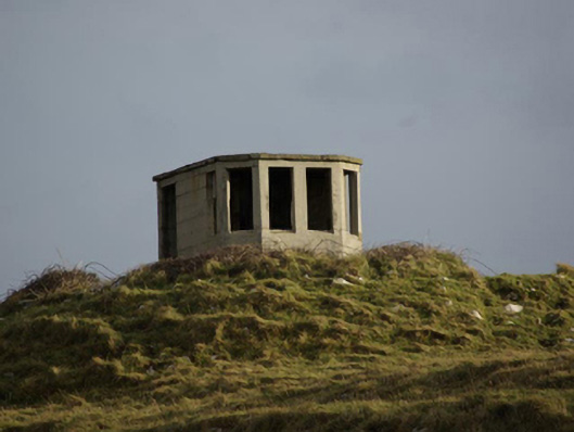
Remains of single-bay single-cell single-storey World War Two-era coastal watchman’s hut, in use c. 1939 – 45, having canted front elevation (south-west). Now out of use. Flat concrete roof. Mass concrete walls having square-headed window openings, fittings now gone. Square-headed doorway to the north-west elevation, fittings now gone. Fire place to interior at the north-east end. Located in a prominent elevated location on an elevated site close to the tip of St. John’s Point, and adjacent to the lighthouse (see 40909717), with extensive sea views to three sides. Located close to the site of a former Napoleonic-era signal tower, now largely demolished above ground level.
This official record and map point do not grant access. Most recorded buildings are privately owned; view them only from public ground unless the owner allows entry.