Add your own picture and explain the route, parking, gates, paths or landmarks that help people find it.
Earn 5 points after the picture is checked and accepted.
Add your photo and local directionsShare what you foundWhat is recorded here
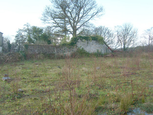
Walled garden complex on irregular-plan associated with Drumbeg House/Clover Hill (see 40909209), erected c. 1820 and extended c. 1860. Now out of use, overgrown and inaccessible in places. Some recent alterations, c. 2007, including infilling of part of walled garden with earth from elsewhere on site. Walls constructed of coursed rubble and random rubble stone masonry with flush roughly dressed quoins to a number of the corners; ashlar and rubble stone coping. Square-headed doorways/entrances in places, now mostly blocked/infilled with rubble stone masonry. Remains of former glasshouses and rubble stone sheds/outbuildings on rectangular-plan to site, now ruinous. Formerly bowed section of boundary wall to the east recently removed. Located to the north-east of Drumbeg House/Clover Hill and to the west of Mountcharles. Site slopes from north/north-east to south/south-west towards the Eany Water and Inver Bay. Former garden pond associated with site (having island) survives to the east (now in separate ownership).
This official record and map point do not grant access. Most recorded buildings are privately owned; view them only from public ground unless the owner allows entry.