Add your own picture and explain the route, parking, gates, paths or landmarks that help people find it.
Earn 5 points after the picture is checked and accepted.
Add your photo and local directionsShare what you foundWhat is recorded here
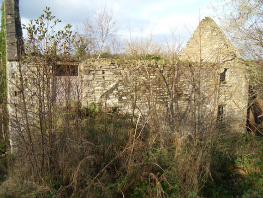
Detached multiple-bay three-storey former corn mill, built or extended c. 1860 and possibly containing the fabric of an earlier mill to site, built c. 1810. Two-storey extension/wing to the west. Now ruinous and out of use. Remains of large composite undershot waterwheel to the north gable end; flight of external stone sets adjacent to waterwheel. Ramp to the east elevation allowing access to doorway at upper floor level. Pitched natural slate roof, now collapsed, and having raised verges to gable ends. Coursed squared rubble stone and rubble stone construction with roughly dressed flush quoins to the corners. Square-headed window openings with stone sills and having remains of multi-pane cast-iron/metal windows. Wrought-iron security bars to a number ground floor window openings. Square-headed door openings with remains of timber battened doors. Composite metal waterwheel to north elevation with surviving timber paddles; internal corn-grinding mechanism now collapsed but surviving. Remains of rubble stone former corn kiln adjacent to the west. Set back from road in overgrown grounds to the west of Mountcharles and to the east of Inver Church of Ireland church. Former mill pond, now dry, to the east; linked to mill by headrace running from the east with remains of sluice. Tailrace to the west formerly discharging into a small stream/unnamed tributary of the Eany Water.
This official record and map point do not grant access. Most recorded buildings are privately owned; view them only from public ground unless the owner allows entry.