Add your own picture and explain the route, parking, gates, paths or landmarks that help people find it.
Earn 5 points after the picture is checked and accepted.
Add your photo and local directionsShare what you foundWhat is recorded here
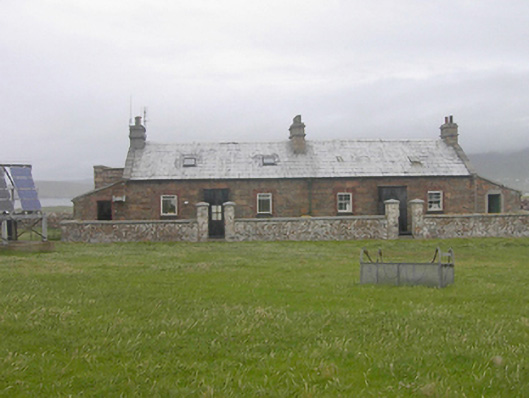
Pair of semi-detached three-bay single-storey former lighthouse keepers’ houses with attic level associated with Rathlin O’Birne Lighthouse, built c. 1856, having lean-to single-bay blocks attached to the gable ends (north-west and south-east). Now in use as stores and occasional dwellings. Pitched natural slate roofs having raised cut stone verges to the north-west and south-east gable ends. Three coursed stone chimneystacks, one to either gable end and one to the centre, having cut stone stringcourses. Cut stone eaves course and cast-iron rainwater goods. Coursed squared rubble stone walls. Square-headed window openings having stone sills, red brick block-and-start surrounds and with two-over-two pane timber sliding sash windows to building to the south-east and replacement windows to building to the north-west. Central square-headed doorways to each building having timber doors. Coursed rubble stone boundary walls to the front (south-west) having cut stone coping over. Pedestrian gateways serving each doorway having ashlar gate piers (on square-plan) having cut stone coping over. High coursed stone walls to the rear (north-east) having cut stone coping over. Single-storey outbuilding adjacent to the south-east having pitched natural slate roof, rubble stone walls and square-headed openings. Associated lighthouses adjacent to the north-west (see 40908904). . Located on the western edge of Rathlin O’Birne Island c. 2 miles off Malin Beg.
This official record and map point do not grant access. Most recorded buildings are privately owned; view them only from public ground unless the owner allows entry.