Add your own picture and explain the route, parking, gates, paths or landmarks that help people find it.
Earn 5 points after the picture is checked and accepted.
Add your photo and local directionsShare what you foundWhat is recorded here
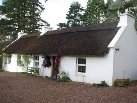
Detached five-bay single-storey thatched house, built c. 1830, having single-storey flat-roofed extension to the rear (north-west). Still inhabited. Pitched thatched roof with raised scalloped ridge with decorative ropework, raised rendered verges to gable ends (north-east and south-west) and having three rendered chimneystacks (one to either gable end and one offset to the south-west side of centre). Smooth rendered walls. Square headed window openings with replacement window fittings. Square headed door opening, offset to north-east side of centre, having timber sheet door. Modern timber canopy over door. Set back from road in own grounds close to the east shoreline of Lough Eske, and to the north-east of Donegal Town. Two-bay single-storey outbuilding to site (north-west) having pitched corrugated metal roof, rubbles tone walls and square-headed doorways with timber sheeted doors. House accessed along laneway from the north-east; laneway flanked along south side by rubble stone boundary wall. Gateway to roadway to the north-east comprising a pair of rubble stone gate piers (on square-plan) having a pair of wrought-iron gates.
This official record and map point do not grant access. Most recorded buildings are privately owned; view them only from public ground unless the owner allows entry.