Add your own picture and explain the route, parking, gates, paths or landmarks that help people find it.
Earn 5 points after the picture is checked and accepted.
Add your photo and local directionsShare what you foundWhat is recorded here
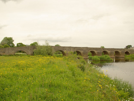
Nine-arch bridge carrying Urney Road over the River Finn, built c. 1680 and possibly containing earlier fabric, having seven arches over river and two dry flood arches to the west end, and with prominent V-profile rubble stone cutwaters to piers rising to form pedestrian refuges at road deck level. Partially remodelled in 1832 (three arches remodelled). Some modern repairs to parapets and modern reinforced concrete underpinning to arches. Round and segmental-headed arches having rubble stone voussoirs; rubble stone construction to arch barrels with recent cement lining over. Roughly coursed rubble stone construction to abutments, spandrels, piers and cutwaters. Rubble stone construction to parapets with rubble stone soldier coping; later ashlar\cut stone coping in sections and modern repairs in blockwork in places. Cut stone corbels to corners of pedestrian refuges supporting road deck. Two memorials to parapets, one with metal Celtic cross motif (undated) and one modern marble plaque commemorating death of IRA member on bridge in 1973. Tarmacadam deck. Parapet walls continues to form rubble stone boundary walls to surrounding fields to east and west. Located in the rural countryside to the east of Castlefinn. Bridge spans the border between County Donegal and County Tyrone, and subsequently the border with Northern Ireland. Cloghfin village to the west\north-west of bridge and Clady village to the east.
This official record and map point do not grant access. Most recorded buildings are privately owned; view them only from public ground unless the owner allows entry.