Add your own picture and explain the route, parking, gates, paths or landmarks that help people find it.
Earn 5 points after the picture is checked and accepted.
Add your photo and local directionsShare what you foundWhat is recorded here
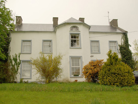
Detached five-bay two-storey over basement country house, built c. 1780, having central full-height canted projection to the main elevation (south), central single-bay two-storey gable-fronted return with attic and basement levels to the rear elevation (north) having single-bay two-storey addition to the east side with mono-pitched roof, and with four-bay two-storey extension to rear at the north-east corner. Pitched artificial slate roof to main body of building having projecting eaves course, raised rendered verges to the gable ends (east and west), cast-iron rainwater goods, and four rendered chimneystacks (one to either gable end and two to the centre flanking central canted projection); hipped artificial slate roof to canted projection. Smooth rendered walls. Square-headed window openings with render architraved surrounds to main elevation (south), painted stone sills, and replacement window fittings. Diocletian\semi-circular window opening to central canted breakfront at attic level having spoked timber fitting. Square-headed doorways to either side elevation of projecting canted breakfront having rendered architraved surrounds, painted plinth blocks, stone thresholds, and replacement doors. Set well-back from road in elevated mature site to the east of Killygordon. Complex of single- and two-storey outbuildings, and former walled garden to the rear (see 40907844). Main gateway to the south-east of house.
This official record and map point do not grant access. Most recorded buildings are privately owned; view them only from public ground unless the owner allows entry.