Add your own picture and explain the route, parking, gates, paths or landmarks that help people find it.
Earn 5 points after the picture is checked and accepted.
Add your photo and local directionsShare what you foundWhat is recorded here
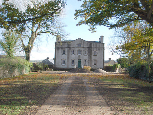
Detached five-bay two-storey over basement former country house with attic level, built c. 1746, having central three-bay breakfront to the front elevation (west) having pediment over with Diocletian window. Site slopes away to the rear (east) with blank five-bay three-storey rear elevation having central pediment with Diocletian window at attic level. Pitched natural slate roofs, hidden behind raised roughcast rendered parapet with cut stone coping over, having roughcast rendered chimneystacks to gable ends with stone copings over, leaded downpipes, decorative hoppers with bird motifs, and brackets with insignia. Roughcast rendered walls with rusticated raised chamfered ashlar quoins to the corners of main body of building and to corners of breakfront, chamfered cut stone plinth over basement level, and with moulded cut stone eaves cornice. Square-headed window openings with stone sills, ashlar stone blocked architraved/Gibbsian surrounds with keystone motifs over, and with four-over-four and six-over-six pane timber sliding sash windows. Nine-over-nine pane timber sliding sash windows at rear at basement level. Smooth render surround to Diocletian window to pediment. Central round-headed door opening to west elevation having timber panelled door with bolection mouldings, ashlar stone blocked architraved/Gibbsian surround, date ‘1746’ to keystone, stone lintel, and with spoked fanlight over. Cut stone coat of arms of George II over doorway. Doorway approach up flight of cut stone steps to cut stone threshold flanked by wrought-iron railings. Low rendered rubble stone boundary wall over basement. Set back from road in extensive mature grounds to the north-east of Lifford and adjacent to the west of the River Foyle. Complex of two-storey outbuildings (see 40907120) to the rear (east) set perpendicular to house alignment. House approached from road to west along tree-lined avenue. Gateway to the west comprising a pair of oversized rubble stone and brick gate piers (on square-plan) having decorative wrought-iron gates. Remains of walled garden with rubble stone walls lined internally with brick to the south. Formal garden to the south with cut stone steps and terraces with rubble stone retaining walls. Outbuildings and modern outbuildings to the north-east.
This official record and map point do not grant access. Most recorded buildings are privately owned; view them only from public ground unless the owner allows entry.