Add your own picture and explain the route, parking, gates, paths or landmarks that help people find it.
Earn 5 points after the picture is checked and accepted.
Add your photo and local directionsShare what you foundWhat is recorded here
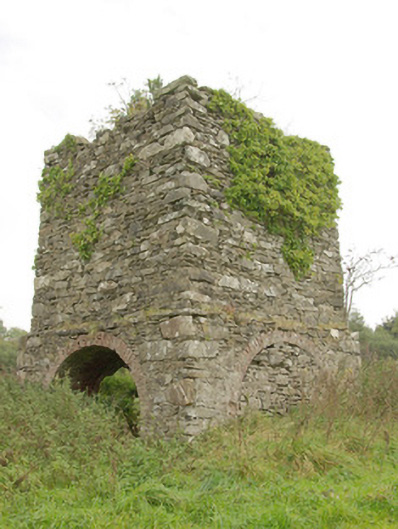
Freestanding tapering two-stage tower\turret\folly (on square-plan), built c. 1780, having projecting base\first stage with open segmental-headed arches to three faces (arch to the east face now infilled with rubble stone masonry. Parapet now denuded. Randomly coursed rubble stone walls, remains of cut stone coping over projecting base stage. Square-headed opening to the north elevation having cut stone sill\threshold. Series of three segmental-headed arches at first stage level having brick reveals. Brick groin vaulted roof structure to interior at base\first stage level. Located on the summit of a small hillock to the south of Green Hills (see 40907022), and to the south-west of Raphoe. Remains of small-scale ornamental pond a short distance to the south-west at corner of field, now partially infilled, formerly with decorative tiled or mosaic flooring (no longer visible).
This official record and map point do not grant access. Most recorded buildings are privately owned; view them only from public ground unless the owner allows entry.