Add your own picture and explain the route, parking, gates, paths or landmarks that help people find it.
Earn 5 points after the picture is checked and accepted.
Add your photo and local directionsShare what you foundWhat is recorded here
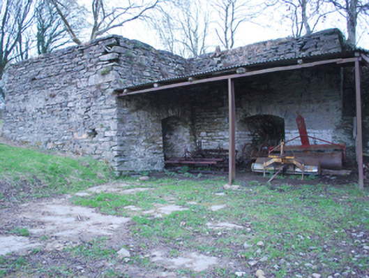
Freestanding two-bay lime kiln on L-shaped plan, erected c. 1820 and extended c. 1860. Now out of use or in use as outbuilding. Constructed of roughly coursed rubble stone masonry with roughly square-quoins to the corners. Segmental-headed openings to front (south) having roughly squared rubble stone voussoirs. Former loading chambers to top having rubble masonry construction; slightly raised rubble stone parapet to front. Built into sloping ground with former quarries to the north-west. Earthen embankment to rear, formerly giving access to loading chambers. Set slightly back from road in rural location to the east\south-east of Manorcunningham. Metal framed structure adjoining to the south-east having corrugated-metal canopy roof over. Cement forecourt to the front. Additional lime kilns to the north-west (see 40905432 and 40905433).
This official record and map point do not grant access. Most recorded buildings are privately owned; view them only from public ground unless the owner allows entry.