Add your own picture and explain the route, parking, gates, paths or landmarks that help people find it.
Earn 5 points after the picture is checked and accepted.
Add your photo and local directionsShare what you foundWhat is recorded here
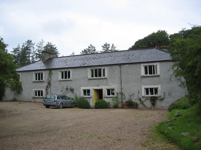
Detached five-bay two-storey complex of former outbuildings (front elevation to southeast) associated with former Church of Ireland glebe house (c.1900, now demolished), built 1828, having two-storey wing to the northeast, and with two ranges of two storey outbuildings to northwest and southwest (arranged around courtyard). Now converted to use as private dwelling (after c.1900); renovated c.1992 following fire damage. Single-storey extension and former conservatory to southwest. Hipped natural purple slate roof with roughcast-rendered eaves course (exposed red brick eaves course to rear) with cast-iron rainwater goods and cement-rendered chimneystacks. Lean-to natural slate roof to extension. Roughcast rendered walls; exposed rubble stone walls to rear. Square-headed window openings to front elevation (southeast) having smooth-rendered surrounds and replacement windows. Square-headed window openings to northeast elevation of block to northeast with flush red brick block-and-start surrounds, some stone sills and mainly six-over-six pane timber sliding sash windows at first floor level and with three tripartite Wyatt-style timber sliding sash windows at ground floor level. Central square-headed doorway to main elevation with smooth-rendered surround, timber panelled door with bolection mouldings, and with flanking square-headed windows with smooth-rendered surrounds and replacement windows. Two ranges of two-storey outbuildings attached to southwest; hipped natural slate roofs with shallow projecting eaves course and some surviving cast-iron rainwater goods; roughcast-rendered walls; square-headed window openings at first floor level having smooth-rendered surrounds, stone sills and battened timber loading bays and timber louvered fittings; square-headed openings at ground floor level with battened timber doors and square-headed carriage-arches with battened timber double-leaf doors. Section of walling to southwest of main dwelling block having gateway to cobbled yard with pair of roughcast-rendered rubble stone square-plan gate piers with pyramidal caps and having double-leaf wrought-iron flat-bar gate with integral round-headed pedestrian gate. Set back from road in extensive mature landscaped grounds in countryside south of Ramelton. Remains of small sub-pentagonal-plan walled garden to southeast, with rubble stone walls. Former gate lodge to north, recently renovated (2016). Gateway to southeast having pair of monolithic octagonal-plan cut-stone gate posts with pyramidal caps, at start of long approach avenue to house from southeast.
This official record and map point do not grant access. Most recorded buildings are privately owned; view them only from public ground unless the owner allows entry.