Add your own picture and explain the route, parking, gates, paths or landmarks that help people find it.
Earn 5 points after the picture is checked and accepted.
Add your photo and local directionsShare what you foundWhat is recorded here
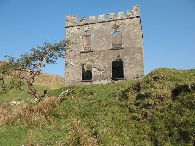
Detached two-bay two-storey house, built c.1850. Now roofless, having rendered rubble stone crenellated parapets above stone string course. Rendered rubble stone walls. Square-headed openings, lacking fittings, with doorway to east elevation. Ruins of rubble stone structures to southeast. Building stands in isolated position on north bank of Sruthán Mhín na gCopóg [Meennagoppoge Burn] as it flows into the east end of Loch Alltáin [Altan Lough]
This official record and map point do not grant access. Most recorded buildings are privately owned; view them only from public ground unless the owner allows entry.