Add your own picture and explain the route, parking, gates, paths or landmarks that help people find it.
Earn 5 points after the picture is checked and accepted.
Add your photo and local directionsShare what you foundWhat is recorded here
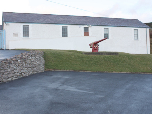
Complex of detached and formerly detached single-storey buildings associated with Dunree coastal defence battery (see 40901813 for Napoleonic fortification; see 40801826 for later battery, built 1895 - 97), built c. 1860 and extended c. 1910. Three formerly detached buildings to east now modified for use as café, shop, and as gallery and museum, with modern single-storey glazed sections linking the buildings to the rear. Formerly detached five-bay single-storey building over partially raised basement level to the south-west end of complex having pitched natural slate roof with rendered chimneystack to the north-east pitch, roughcast rendered walls, square-headed window openings with cut stone sills, painted flush roughly squared stone block-and-start surrounds and six-over-six-pane timber sliding windows, and central doorway to front elevation having replacement timber panelled door with plain overlight; doorway reached by flight of steps from the west end having cement rendered wall south. Modern glazed section to the rear (north-east) of five-bay single-storey building (see above) linking building with five-bay single-storey structure having pitched natural slate roof with rendered chimneystack to the rear pitch, rubble stone walls with roughly dressed and squared stone quoins to the corners, square-headed window openings with stone sills, roughly dressed flush roughly squared stone block-and-start surrounds and six-over-six-pane timber sliding windows, and with square-headed doorway to the north-east end of the rear elevation (north-east) having flush roughly squared stone or concrete block-and-start surrounds and replacement timber door. Formerly detached single-storey building to the north-east end of complex of three buildings, now attached to central building to south by modern glazed linking structure, having pitched natural slate roof, roughcast rendered rubble stone walls, and square-headed window openings with stone sills and six-over-six pane timber sliding sash windows. Detached four-bay single-storey building with attic level to the rear of group of three buildings linked by modern glass sections, possibly formerly a toilet or shower block, having pitched natural slate roof with raised rendered verges to the gable ends, rubble stone walls, square-headed window openings to the north-west gable end with wrought-iron security bars and six-over-six pane timber sliding sash windows, and with square-headed doorways to the front elevation (south-west) having concrete block-and-start surrounds and battened timber doors; concrete steps to each doorway. Rubble stone boundary walls to site. Altered single-storey buildings to the south-east of site having pitched slate and artificial slate roof, rendered walls, and square-headed openings; building to south-west of this complex now in use as a café. Detached six-bay single-storey building to the west of complex, built c. 1910, having two single-bay flat-roofed porch extensions to the east\south-east elevation, single-bay flat-roofed porch extension to the north-east gable end, and with single-storey extension to the centre of the rear elevation (west). Pitched artificial slate roof with two cement rendered chimneystacks with clay pots over. Roughcast rendered walls over moulded red brick plinth course; cement rendered finish to porches to the north-east end of the main elevation and to the north-east gable end, red brick construction to porch to the south-west end of the main elevation. Square-headed window openings with moulded timber surrounds, timber sills, and timber casement windows (some with fixed-pan timber windows over), metal security meshes to openings. Square-headed doorways to porches having replacement battened timber doors and double doors, concrete lintel over doorway to the south-west end of front elevation. Square-headed doorway to the centre of the front elevation (east) having timber battened double-doors with multiple-pane timber overlight. Detached red brick toilet block to the south-east of building to the west having moulded red brick coping over; rubble stone boundary walls to site having random rubble stone coping over. Buildings set within larger complex of structures associated with fort Dunree, located to the east of the Napoleonic fort (see 40901801); to the west of the later fort (see 40901826) on the summit of Dunree Hill, and to the west of the substantial complex of corrugated-metal clad buildings (see 40901824).
This official record and map point do not grant access. Most recorded buildings are privately owned; view them only from public ground unless the owner allows entry.