Add your own picture and explain the route, parking, gates, paths or landmarks that help people find it.
Earn 5 points after the picture is checked and accepted.
Add your photo and local directionsShare what you foundWhat is recorded here
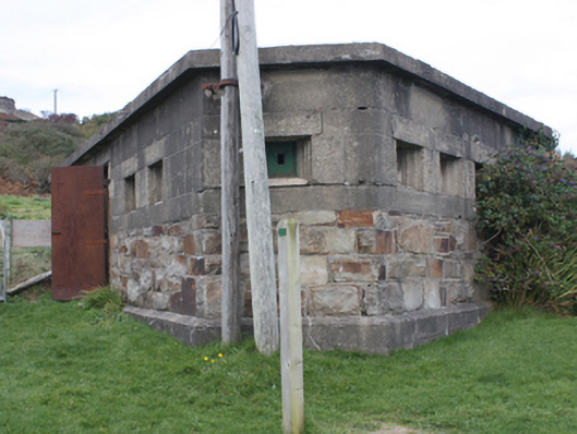
Detached five-bay single-storey former guard house on wedge-shaped plan positioned at to east side of main gateway to Dunree coastal defence battery (see 40901813 for Napoleonic fortification; see 40801826 for later battery, built c. 1910. Now out of use. Flat concrete roof, slightly overhanging walls. Squared and coursed rock-faced section to lower section of wall surmounted by reinforced concrete upper-section, projecting chamfered plinth course. Square-headed recessed gun loop openings to three sides with stepped concrete-block reveals and sheet-metal inner guard with central gun opening. Central square-headed door opening to main elevation with plate metal door. Single-storey corrugated-metal sentry hut to west side of main gateway to Fort Dunree having mono-pitched corrugated-metal roof, corrugated-metal clad walls, and having square-headed window and door openings. Detached three-bay single-storey former guard house to north of barrack complex having flat concrete roof; red brick walls (running bond), square-headed window openings with metal shutters, blocked square headed openings at plinth level to either side of doorway, and central square-headed doorway with metal double-doors. Main guard house located to the south of the old Fort Dunree (see 40901813) and to the south-west of the later fort (see 40901826). Pillboxes and ancillary structures to site (see 40901825), and complex of single-storey former barracks buildings to the north and north-east of site.
This official record and map point do not grant access. Most recorded buildings are privately owned; view them only from public ground unless the owner allows entry.