Add your own picture and explain the route, parking, gates, paths or landmarks that help people find it.
Earn 5 points after the picture is checked and accepted.
Add your photo and local directionsShare what you foundWhat is recorded here
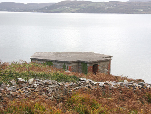
Complex former single-storey pillboxes and single-storey lookout positions associated with Fort Dunree (see 40901813 and 40901826), built c. 1920 and c. 1940. Now disused. Flat concrete roofs, some gently sloping from front to rear creating larger field of vision. Reinforced concrete and cement rendered walls; red brick construction in places to a number of the former watch huts\stations. Square-headed window and door openings with remains of metal fittings. Pillboxes\watch posts (on canted-plan) located along perimeter of later fort (see 40901826), c. 1897, to the summit of Dunree Hill. Two former pillboxes and\or look-out posts located on an island to the south-west of site, connected to mainland by timber footbridge with timber safety railings. Single-bay single-storey structure located on highest point to north-east of original Fort Dunree (see 40901813), probably originally in use as a communications\radio hut, having flat concrete roof, reinforced concrete walls, and square-headed window opening with remains of two-over-two pane timber sliding sash window, square-headed doorway with remains of timber door, and with radio aerial\antennae adjacent. Buildings located throughout site, strategically positioned to afford viewing\field of fire in majority of directions. Located on cliff-edge and slopes of Dunree Hill at Dunree Head peninsula to east bank of Lough Swilly.
This official record and map point do not grant access. Most recorded buildings are privately owned; view them only from public ground unless the owner allows entry.