Add your own picture and explain the route, parking, gates, paths or landmarks that help people find it.
Earn 5 points after the picture is checked and accepted.
Add your photo and local directionsShare what you foundWhat is recorded here
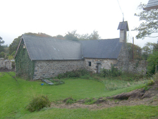
Detached single-storey outbuilding with attic level on L-shaped plan associated with Mulroy House (see 40901712), built c. 1890, having cut stone bellcote over the north-west gable end to the block to the north-west. Pitched natural slate roofs with overhanging eaves having exposed rafter ends, decorative curvilinear timber bargeboards to gable ends, and with triangular-shaped cast-iron gutters. Bellcote to gable wall to north-west having dressed ashlar limestone construction with corbelled brackets to base, loop hole opening over, square-headed opening with bell metal bell, and having pitched natural slate roof over with decorative curvilinear timber bargeboards, and surmounted with metal weather vane finial. Coursed rubble stone walls with dressed and tooled ashlar block-and-start quoins to the corners having drafted margins. Square-headed window openings, fittings now gone; square-headed window opening with timber lintel to north-east elevation. Square-headed opening with yellow-brick surround to upper level to north-east gable elevation with loop hole over to gable apex having cut stone surround. Square-headed doorway to the north-east face of block to the north-west having cut stone corbels to the head creating false shouldered opening, cut stone lintel, and with battened timber door. Set within the Home Farm (see 40901713) to the west of Mulroy House is extensive mature grounds. Stone boundary walls to south-east and north-west.
This official record and map point do not grant access. Most recorded buildings are privately owned; view them only from public ground unless the owner allows entry.