Add your own picture and explain the route, parking, gates, paths or landmarks that help people find it.
Earn 5 points after the picture is checked and accepted.
Add your photo and local directionsShare what you foundWhat is recorded here
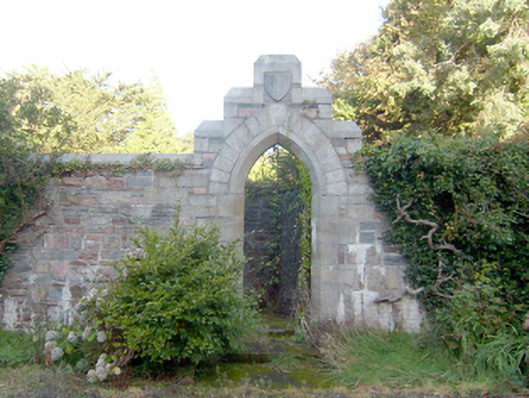
Walled garden complex originally on sub rectangular-plan with canted corner to the north-west associated with Mulroy House (see 40901712), dated erected c. 1876. Now out of use and inaccessible in places. Squared and snecked rubble stone boundary walls with chamfered tooled stone coping over. Integral pointed-arch pedestrian entrance to the south-east having ashlar granite block-and-start surround with chamfered reveal, decorative wrought-iron gate, and with stepped parapet over having chamfered ashlar coping and with cut stone date plaque incised ‘1876’; cut stone steps and rubble stone boundary wall to interior of gateway giving access to raised garden. Single-storey outbuildings (see 40901762) to the north-west corner of interior boundary wall. Garden is surrounded by mature woodland. Mature tress to site. Located adjacent to the north-west of Mulroy House in extensive mature landscaped grounds to the east of Carrickart.
This official record and map point do not grant access. Most recorded buildings are privately owned; view them only from public ground unless the owner allows entry.