Add your own picture and explain the route, parking, gates, paths or landmarks that help people find it.
Earn 5 points after the picture is checked and accepted.
Add your photo and local directionsShare what you foundWhat is recorded here
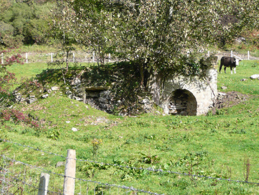
Freestanding two-bay lime kiln on rectangular-plan, erected c. 1800, having square-headed aperture to the west and round-headed aperture to the east. Set into natural slope in field. Now out of use with trees growing from site. Constructed of roughly coursed rubble stone masonry and rubble stone masonry. Roughly squared stone lintel over square-headed kiln, roughly dressed rubble stone voussoirs to round-headed aperture. Former loading bays to summit, now partially collapsed. Earthen embankment to rear, formerly giving access to loading chambers. Set back from road in rural location to the north-east of site of Springfield House (built c. 1688 and demolished in 1968) and to the south-west end of the Fanad Peninsula.
This official record and map point do not grant access. Most recorded buildings are privately owned; view them only from public ground unless the owner allows entry.