Add your own picture and explain the route, parking, gates, paths or landmarks that help people find it.
Earn 5 points after the picture is checked and accepted.
Add your photo and local directionsShare what you foundWhat is recorded here
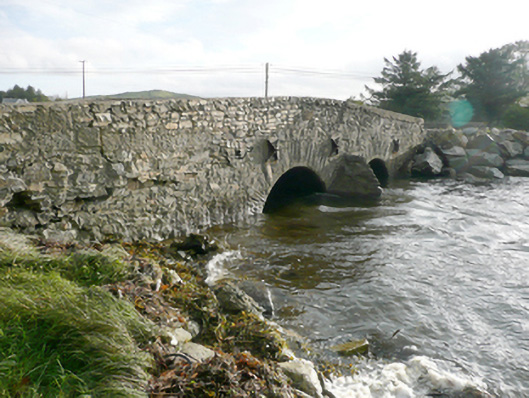
Double-arched bridge carrying road over tidal estuary\unnamed stream flowing into Keadew Bay to the north-west, built c. 1780, having V-profile rubble stone cutwater to central pier to both the north and south elevations. Bridge rises from either end to centre creating slightly hump-backed from. Segmental-headed arches having rubble stone voussoirs; rubble stone construction to the arch barrels. Random rubble stone construction to pier, spandrels, and parapets. Modern repairs in places, cement coping to parapets. Cast-iron pattrice plates to side elevations (north and south) linked with wrought-iron tie bars. Water pipe to the north elevation. Tarmacadam deck. Located to the south of Rosnakill to the south-west of the Fanad Peninsula.
This official record and map point do not grant access. Most recorded buildings are privately owned; view them only from public ground unless the owner allows entry.