Add your own picture and explain the route, parking, gates, paths or landmarks that help people find it.
Earn 5 points after the picture is checked and accepted.
Add your photo and local directionsShare what you foundWhat is recorded here
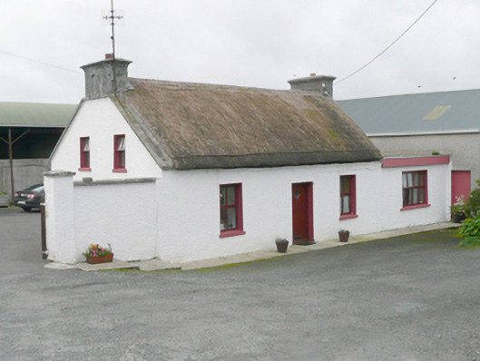
Detached three-bay single-storey vernacular house with attic level, built c. 1825, having single-bay single-storey flat-roofed extension attached to the west. Pitched thatched roof with raised render verges and smooth rendered chimneystacks to the gable ends (east and west) having cornice copings over. Roughcast rendered walls. Square-headed window openings with painted concrete sills, and replacement timber casement windows. Central square-headed doorway to the north elevation having battened timber door. Set back from and perpendicular to road and accessed via laneway to Church of Christ the Redeemer, Rosnakill (see 40901701). Roughcast rendered boundary wall attached to the east gable end. Yard to rear (south) having collection of modern farm buildings and outbuildings. Located to the south of Rosnakill, and a short distance to the east of Doocarrick Bay.
This official record and map point do not grant access. Most recorded buildings are privately owned; view them only from public ground unless the owner allows entry.