Add your own picture and explain the route, parking, gates, paths or landmarks that help people find it.
Earn 5 points after the picture is checked and accepted.
Add your photo and local directionsShare what you foundWhat is recorded here
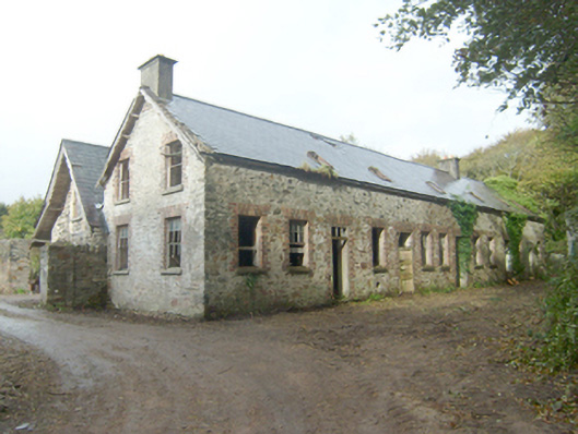
Detached fourteen-bay single-storey farm building with attic level associated with Mulroy House, built c. 1905. L-shaped plan with six-bay single-storey extension forming a courtyard to north-west. Double-pitched slate roof with rendered chimneys. Overhanging eaves supported by timber trusses set on carved corbels to north-west. Decorative bargeboards, rooflights to south-east, no remaining rainwater goods. Rubble stone walls, remains of lime render. Square-headed openings with redbrick and yellow brick reveals and voussoirs, stone sills. Open ground floor with shouldered false arches to carriage openings with timber lintels over to north-west elevation. Dressed quoins to stone columns. Timber sheeted doors with fanlight over. Six over six timber sliding sash windows and casement windows. One central dormer opening to south-west elevation. Set amongst a series of derelict former farm buildings at the Home Farm south-east of Stewards House (40901749) and south-west of Mulroy House. Mature trees to the south.
This official record and map point do not grant access. Most recorded buildings are privately owned; view them only from public ground unless the owner allows entry.