Add your own picture and explain the route, parking, gates, paths or landmarks that help people find it.
Earn 5 points after the picture is checked and accepted.
Add your photo and local directionsShare what you foundWhat is recorded here
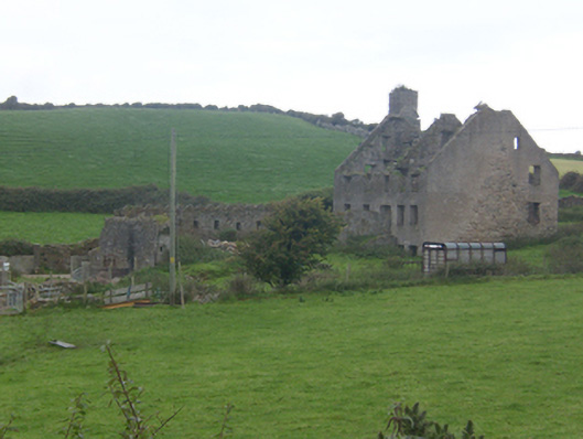
Detached five-bay two-storey over basement house with attic storey or storeys, built c. 1670-1700 and possibly incorporating remains of earlier fortified house to site, built c. 1611. Possibly with remains of defensive porch to the south-west elevation, now ruinous. Now derelict and out of use. Originally with steeply pitched roof, now collapsed, having remains of partially lime roughcast rendered rubble stone chimneystack to the north-west gable end. Chimneystack to the south-east gable end, and probably to the central partition wall now collapsed. Remains of angled corner fireplaces to the gable end walls to interior. Partially roughcast rendered rubble stone walls. Irregularly-spaced square-headed window openings having rubble stone voussoirs; sills and fittings now removed. Square-headed doorways, fittings now removed. Remains of rubble stone (partially defensive) former entrance porch to the south-west elevation, now partially collapsed. Remains of brick fireplace and brick-lined oven survive to former kitchen to the south-east corner at basement level. Set back from road in own grounds in the rural countryside to the south-east\east of Dunfanaghy close to summit of Mullaghdoney Hill and close to Portnablagh Pier and Portnablagh. Set within the remains of former defensive bawn (on rectangular-plan) having rubble stone walls with rounded battlements over, and with regular gun loops along the north-west wall having splayed internal reveals. Remains of flanking towers (on square-plan) to corners. Remains of integral four-centred arched entrance with chamfered stone reveals to the south-west side. Interior of bawn is raised in comparison to exterior ground level; remains of footings of former buildings surviving to the north-west and north-east sides of bawn interior. Site now associated with modern farm complex to the south-west.
This official record and map point do not grant access. Most recorded buildings are privately owned; view them only from public ground unless the owner allows entry.