Add your own picture and explain the route, parking, gates, paths or landmarks that help people find it.
Earn 5 points after the picture is checked and accepted.
Add your photo and local directionsShare what you foundWhat is recorded here
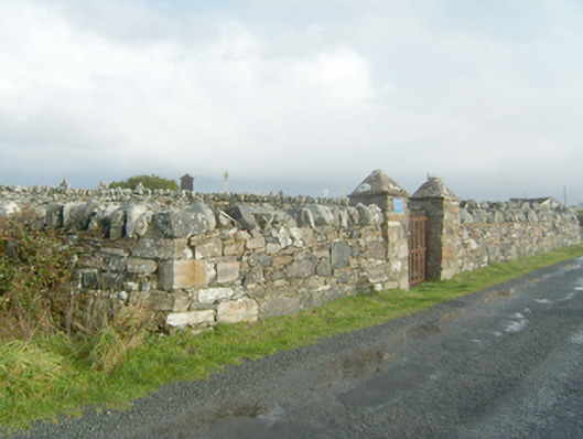
Group of three graveyards (on sub rectangular-plans), in use c. 1760 until c. 1940, comprising a paupers’ graveyard to the west and with Catholic and Church of Ireland graveyards to the east. Pauper’s graveyard contains mainly unmarked graves associated with Dunfanaghy Union Workhouse (see 40807008) to the north-west, and a number of iron crosses commemorating individuals drowned at sea. Timber cross and memorial stone to pauper's graveyard. Catholic graveyard contains collection of mainly upstanding monuments of nineteenth and twentieth century date, some with metal railed enclosures. Earliest legible gravemarker commemorates Neal Tuohy (?), dated July 1778. Church of Ireland graveyard contains collection of mainly upstanding twentieth-century gravemarkers; earliest gravemarker dated 1881. Site surrounded by rubble stone boundary walls with rubble stone solider coping over. Gateway to paupers’ graveyard to the south comprising a pair of rubble stone gate piers (on square-plan) having rubble stone coping over, and with wrought-iron flat bar gate. Gateway to Catholic and Church of Ireland graveyards to the south-east corner of site having comprising a pair of rubble stone gate piers (on square-plan) having rubble stone coping over, and with wrought-iron flat bar gate. Former penal mass station (see RMP DG015-017001-), c. 1750, built up against the outside wall to the east boundary comprising masonry platform. Located in the rural countryside to the south-west of Dunfanaghy. Former church and graveyard (see 40901517) to the west.
This official record and map point do not grant access. Most recorded buildings are privately owned; view them only from public ground unless the owner allows entry.