Add your own picture and explain the route, parking, gates, paths or landmarks that help people find it.
Earn 5 points after the picture is checked and accepted.
Add your photo and local directionsShare what you foundWhat is recorded here
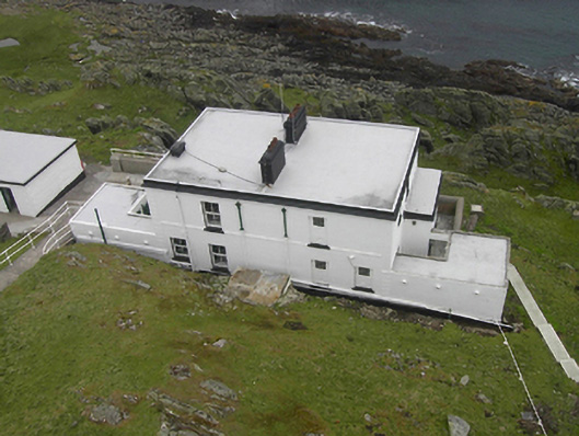
Pair of semi-detached three-bay two-storey former lighthouse keepers’ houses originally possibly associated with a Lloyds Signal Station but later associated with Inishtrahull Lighthouse (see 40900213), built c. 1905, having attached single-bay flat-roofed entrance porches to the side elevation of each structure, and with attached single-storey flat-roofed blocks to the rear of the side elevation of each building. Building to the north-east now in use as originally residence, building to the south-west now in use as storage\office. Flat (felt?) roofs having moulded eaves course and with two rendered chimneystacks to centre; metal rainwater goods. Smooth rendered walls over smooth rendered plinth, and with raised render block-and-start quoins to the corners of the main body of the buildings. Square-headed window openings with two-over-two pane timber sliding sash windows; windows to building to the south-west now infilled with blockwork and glass blocks. Square-headed doorways to front elevation (south-east) of attached porches to former dwellings having replacement and timber doors, and with plain overlights. Cement rendered walls to site. Flight of steps and pathway to the north-east giving access to lighthouse to the north-west. Located at the west end of Inishtrahull Island, about 5 miles to the north of Malin Head. Freestanding fog signal (on hexagonal-plan) to the north-west, built 1905; helicopter pad and single-storey ancillary structure to the north-east.
This official record and map point do not grant access. Most recorded buildings are privately owned; view them only from public ground unless the owner allows entry.