Add your own picture and explain the route, parking, gates, paths or landmarks that help people find it.
Earn 5 points after the picture is checked and accepted.
Add your photo and local directionsShare what you foundWhat is recorded here
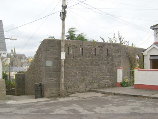
Sections of boundary wall on irregular-plan surrounding site of former Rock Barracks, erected c. 1798. Barracks now demolished, formerly on D-shaped plan extending to the south of the present sites. Constructed of roughly squared and coursed limestone with chamfered dressed limestone coping over, and having flush dressed limestone bloc-and-start quoins to the corners. Square-headed gun loops with dressed limestone surrounds and having splayed openings to the inner side located at strategic locations along length of walls, particularly close to corners and defending flight of steps to the north, west and east sides. Located in an elevated location on a rocky outcrop overlooking Ballyshannon town and Ballyshannon Bridge from the south. Modern housing estate located to the south-east and south-west, built c. 1936. Concrete steps with rendered boundary walls to the west and north of site leading down to West Port Road.
This official record and map point do not grant access. Most recorded buildings are privately owned; view them only from public ground unless the owner allows entry.