Add your own picture and explain the route, parking, gates, paths or landmarks that help people find it.
Earn 5 points after the picture is checked and accepted.
Add your photo and local directionsShare what you foundWhat is recorded here
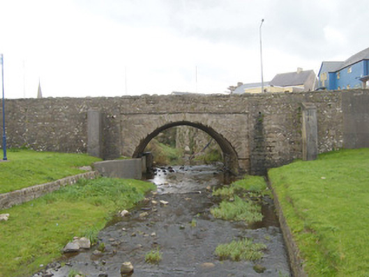
Single-arch road bridge, built c. 1860, carrying road over the Bradoge River. Widened to south-east elevation c. 1980. Possibly incorporating the fabric of an earlier bridge to site (Ordnance Survey first edition six-inch map c. 1836). Segmental-headed arch to north-west elevation with rock-faced sandstone voussoirs to arch having dressed margins. Arch flanking by rubble stone buttresses to either side (to north-west elevation) having roughly dressed quoins to corners. Coursed squared rubble stone masonry to spandrel walls, abutments and to parapets. Projecting rock-faced stringcourse at arch springing points, running under arch barrel. Cement rendered finish to arch barrel. Rock-faced coping to north-west parapet; projecting rock-faced stringcourse at road deck level to the north-west elevation. Rubble stone wing walls to either side of north-west elevation (north-east and south-west) having rock-faced coping over. Random rubble sandstone to modern south elevation extension with stone coping to parapets and stone coping over retaining walls. Located to the south-west end of the Main Street, Bundoran, close to where the Bradoge River flows into Donegal Bay.
This official record and map point do not grant access. Most recorded buildings are privately owned; view them only from public ground unless the owner allows entry.