Add your own picture and explain the route, parking, gates, paths or landmarks that help people find it.
Earn 5 points after the picture is checked and accepted.
Add your photo and local directionsShare what you foundWhat is recorded here
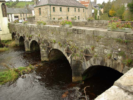
Five-arched bridge carrying road over the Termon River, built c. 1770, having cut stone/ashlar triangular-profile cutwater to piers to both elevations (north and south) with domed caps over. Constructed of irregularly-coursed squared rubble stone masonry to spandrels, piers and to parapets. Wrought-iron tie bars with cast-iron pattrice plates. Roughly dressed stone coping to parapets with cement repairs in places. Round-headed arches having dressed voussoirs and with rubble stone construction to the arch barrels. Tarmacadam deck Located to the east/south-east of Pettigoe town centre. Bridge spans the border between Northern Ireland and the Republic of Ireland.
This official record and map point do not grant access. Most recorded buildings are privately owned; view them only from public ground unless the owner allows entry.