Add your own picture and explain the route, parking, gates, paths or landmarks that help people find it.
Earn 5 points after the picture is checked and accepted.
Add your photo and local directionsShare what you foundWhat is recorded here
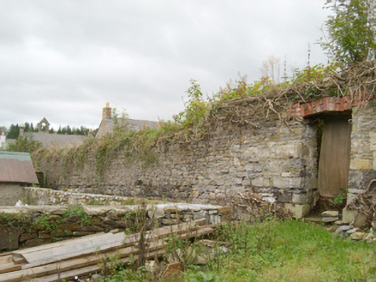
Walled garden on rectangular-plan, erected c. 1800 and renovated c. 1930 and 2008. West elevation now collapsed; now out of use. South side incorporates wall of outbuilding associated with house to south (see 40850019). Rubble stone walls with cut stone coping over in sections. Flush ashlar block-and-start quoins to the north-east corner. Integral segmental-headed doorway to the north end of the east side of walled garden having brick voussoirs, cut stone plinth blocks, and cut stone step; opening now blocked with timber panel. Integral segmental-headed doorway to the south side of garden, adjacent to the east elevation of outbuilding, having brick voussoirs; doorway addressed by modern flight of concrete steps. Square-headed entrances to the north-west and south-west corners of garden each having concrete lintel over (c. 1930). Garden overgrown to interior with variety of mature fruit trees still extant. Associated with a terrace of three houses to the south built by the Leslie family (see 40850018 to 40850020). Located a short distance to the north-west of the centre of Pettigoe.
This official record and map point do not grant access. Most recorded buildings are privately owned; view them only from public ground unless the owner allows entry.