Add your own picture and explain the route, parking, gates, paths or landmarks that help people find it.
Earn 5 points after the picture is checked and accepted.
Add your photo and local directionsShare what you foundWhat is recorded here
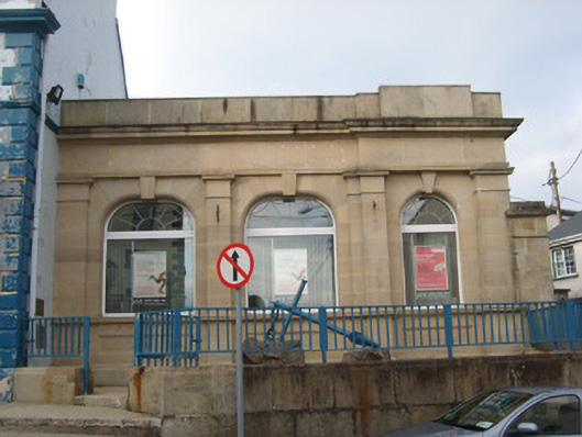
Attached three-bay single-storey extension to bank (see 40845008), built c. 1921, having slightly advanced bay to the north-east end of the main elevation (south-east). Roof hidden behind raised sandstone parapet with sandstone coping over, and pronounced sandstone cornice at eaves level. Ashlar sandstone walls over moulded sandstone plinth, moulded sandstone stringcourse over window openings to main elevation, sandstone apron panels under window openings having recessed rectangular panels, and having projecting sandstone pilasters (on square-plan) between window openings having capitals over. Smooth rendered finish to rear elevation. Shallow segmental-headed and round-headed (to projecting bay) window openings having moulded sandstone surrounds, projecting keystones, continuous ashlar sill course, and replacement window openings. Square-headed window openings to the north-east side elevation having moulded architrave surrounds and replacement window. Set slightly back from road to the centre of Killybegs. Raised platform to the south accessed by flight of steps. Ashlar sandstone boundary wall to front having moulded coping and modern metal railings over. Gateway to the north-east comprising a pair of ashlar sandstone gate piers (on square-plan) having capstones over with moulded cornice detailing. Coursed and squared rubble stone boundary wall to the north-east of gateway.
This official record and map point do not grant access. Most recorded buildings are privately owned; view them only from public ground unless the owner allows entry.